Travelog


6/18

← older posts newer posts →


6/18    Started towards Fort Simpson, retracing Rt 3 – no buffalo this time. Drove through the town of Fort Providence, a simple one general store town on the banks of the Mackenzie River. Surprisingly, the town also had a fairly large medical clinic; how a town of 450 people, in the middle of nowhere, can support the clinic is a mystery. Camped at Fort Providence Territorial Park and caught a nice sized northern pike for dinner. Saw several bald eagles soaring over the river.


6/19

6/19     Left Ft Providence early since we didn’t know what conditions on the 70 mi gravel part of Rt 1 would be; as it turned out, very good but dusty and dirty. Stopped at Sambaa Deh Falls Territorial Park to view the falls. Had a delightful conversation with Ranger Ray who filled us in on the trails, fossils and morel hunting in and around the park. He also clued us in to the goings on in Ft Simpson – this weekend is the 3rd Annual Łĺĺdļļ Kųę First Nation Traditional Spring Gathering which has many games, dances and free BBQs. Walked, with the dogs down to the falls; Tat sprained his paw so I had to carry him back, so we never made it to the falls. Samba Deh is a beautiful park and would be a delightful place to camp and spend several days hiking and enjoying, unfortunately, we can’t dally, Alaska beckons. Left the park and continued; about 5mi further on we encountered a black bear strolling down the road towards us. About 50 mi down the road we had a free ferry ride across the Liard River and several miles after we reached Fort Simpson where we camped at the Fort Simpson Territorial Park.

Liard River Ferry

Liard River Ferry

Black Bear

Black Bear


6/20

Sandhill Cranes

Sandhill Cranes

6/20 Went to the Fort Simpson Visitor Center, which had an interesting exhibit of local history, and used their internet; it wasn’t fast but did allow us to make some phone calls. As we left the Center a flock of Sandhill Cranes stalked across an adjacent field looking for food. We then went to watch the Hand Games. The games, a traditional Dene sport, are actually quite subtle and complicated but a simplistic explanation is as follows: There are two teams each with 4-10 players and 10 – 20 supporters with hide drums. Each member of the team that is up has a pebble which he, or she (although the teams we saw were only men) shows to the opposing team and then hides in his hands. The hands are then placed under a sheet and the pebble is passed back and forth between the hands, to the accompaniment of banging drums. During the drumming the opposing team’s captain, using hand signals, directs certain players to show their hands. Eventually, the captain bets, using sticks, on which hand a certain player has hidden the pebble. A game may last all day or until one team has won all the sticks. It was fun the watch but difficult to pick up the signals. After watching the games we went the vendor’s field and feasted on scrumptious moose stew. Up here moose, caribou, beaver and bear, among other wildlife, appear on local menus quite frequently.

Betting Sticks

Betting Sticks

Hand Games

Hand Games

The Captain Signals

The Captain Signals

More Hand Games

More Hand Games

Hand Games Again

Hand Games Again


6/21

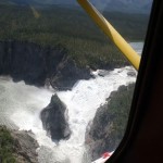
6/21    We flew to Nahanni National Park on a Simpson Air Cessna 185 floatplane. The park is a UNESCO World Heritage Site comprising more than 7 million acres and is a pristine example of Canadian wilderness. It is representative of the Mackenzie mountain range region as it was when it was the exclusive domain of the Dene, before the Europeans arrived. The South Nahanni river, which cuts through the length of the park, has created spectacular canyons, some of which are 3000 – 4000 ft deep, and awe-inspiring rapids and waterfalls. We landed on the river just above Virginia Falls which is twice the height of Niagra and hiked to the top of the falls.

Little Doctor's Lake

Imagine Waking Up to This – View of Little Doctor’s Lake from Nahanni Mountain Lodge

Virginia Falls

Virginia Falls

The violence of the rapids leading to the falls was amazing; unfortunately time did allow us to take the 2 hour hike to the bottom, so we didn’t get a view of it’s true magnificence. On the way back to Fort Simpson we landed on Little Doctor’s Lake to see the Nahanni Mountain Lodge, owned and run by Ted Grant the owner of Simpson Air and had an enjoyable time talking with a group of men who had rented the Lodge for the week. What a gorgeous place to get away from it all and just relax and fish. The trip was well worth it both for the scenery and the enjoyment of meeting new people. However, Arlyne did find the flight to be extremely bumpy and nauseating, and vowed never to fly in a small plane again. I, however, totally enjoyed the trip, perhaps because I love sailing, with it’s constant interaction with the wind, and found the flight quite delightful.

More Nahanni National Park Photos


6/22

6/22  

Muskeg

Muskeg

Drove back down Rt 1 and then onto Rt 7; landscape along the way is mostly muskeg, basically bog. Rt 7 is mostly gravel, which means everything gets covered with a fine layer of rock dust, we’ll be cleaning it out of the camper for the next year. Stopped at Blackstone Territorial Park which has a spectacularly beautiful setting on the Laird River, another campground it would be wonderful to spend time exploring. Stopped at Fort Liard to gas up; a nice little town (population 500). Camped at Triple G campground, Fort Nelson, BC. – felt like a sardine but it was late and the only place to camp

Blackstone Territorial Park

View from Blackstone Territorial Park


6/23

6/23

Pretty View

Pretty View

Pitzed around Fort Nelson looking for diesel oil and a bug screen for the truck’s radiator, check on the oil but no go on the bug screen; so I’ll make one from window screening. Driving Rt 97 west from Fort Nelson is a fun drive; it’s all twisty-turney and upsy-downzy with steep inclines going through the mountains; it would be a dream in a Porsche or a Ferrari.  The major problem with the road is that the scenery is incredibly gorgeous so we kept stopping for photos, even in the rain. Saw mama bear and cubs, stone sheep, and a wood buffalo herd. Finally arived at Liard Hot Springs Provincial Park. Set up the camper and soaked in the springs – Ahhhh!

Stone Sheep and Lamb

Stone Sheep and Lamb


Mama Bear and Cubs

Mama Bear and Cubs


Liard Hod Springs Ahhh!

Liard Hod Springs Ahhh!

More Photos


6/24

6/24  

Smokey Haze

Smokey Haze

Rancheria Falls

Rancheria Falls

Continued along Rt 1 stopping at several rapids and falls along the way. Smokey haze from forest fires made taking distance shots chancy. Whirlpool Canyon, Laird River Rapids and Rancheria Falls. Buffalo all over the place along with a small Grizzly bear and later, a Black bear. Stopped at Watson Lake to view the signpost forest and put up a sign. The Alaska Highway Museum, in the Visitor’s Center, is really worth viewing, it gives one a good appreciation of what was involved in building the highway . Camped at Dawson Peaks Campground, Teslin, YK; very nice view of Teslin Lake and only 2 other campers.

Watson Lake Signpost Forest

Watson Lake Signpost Forest

Our Sign

Our Sign


Grizzly Bear

Grizzly Bear


6/25


6/25   Left Teslin early, heading towards Whitehorse along Rt.1. Nothing of particular note along the way, just pretty scenery – how boring. Stopped at Teslin which has two museums one should visit: George Johnson and the Tlingit Heritage Center (Tlingit pronounced “cling kit”). George Johnson was an accomplished Tlingit businessman and photographer who lived in Teslin in the early 1900’s. In 1928 George decided to buy a new four door Chevrolet. There were several problems which George had to overcome, however. The first being that the car was in a dealership in Whitehorse which was over 100 miles from Teslin and there were no roads also, there were no roads in Teslin. George had the car shipped on a paddle wheeler down the Yukon River, up the Teslin River and across Teslin Lake, a journey of about 500 miles. While he was waiting for the car George built a road around Teslin and when the car arrived, sold tickets for rides. In the winter he would sell tickets to go hunting on Lake Teslin – he painted the car white, in winter, for camouflage. The car, in gorgeous condition, is a centerpiece of the museum.

The Tlingit Heritage Center provides a view into the day-to-day life of the Tlingit people and explains their history and culture. It is well worth a stop.

Dropped the camper at the Caribou RV Park in Whitehorse and headed into town to make appointments to change the truck’s oil, and a veterinarian for our oldest dog’s eye infection and nose bleeds. Visited the Government of Yukon building to see the Legislature; rather disappointing after the NWT. The building is quite utilitarian, it houses the administrative offices and has a single Assembly meeting room – it seemed almost an afterthought. We came away feeling that the Assembly Delegates were considerably less important than the administrative bureaucrats.

Yukon Government Building

Yukon Government Building

Legislative Assembly Meeting Hall

Legislative Assembly Meeting Hall

Stained Glass Panels in Government Building

Stained Glass Panels in Government Building

More Stained Glass Panels

More Stained Glass Panels


6/26 – 6/28

6/26 – 6/28   The days were taken up doing chores: oil change, vet visit, shopping and walking the town. Whitehorse, the capital of the Yukon, is a fairly large town with a population of 26,000, which considering that Yukon’s total population is only 34,000, means that almost everyone you meet in the Yukon lives in Whitehorse. As in all Yukon towns, there is a large presence of First Nation people which gives the town a distinctive vibrance and a can-do atmosphere. We visited the MacBride Museum of Yukon History which showcases the accomplishments of the early residents: First Nation people, miners, entrepreneurs, statesmen, etc; definitely a worthwhile stop.  Also stopped by the Whitehorse dog park.

First Nation Baskets

First Nation Baskets


Elmer White, Writer/Editor

Elmer White, Writer/Editor


NWMP-Office/Home

NWMP-Office/Home


NWMP Office/Home

NWMP Office/Home


Canine Bluffs Dog Park

Canine Bluffs Dog Park

Walking the streets of Whitehorse we saw some sculptures, which appeared to be headless people, at the entrance to a building across the street .  The building was the Law Courts and it seemed a rather stark comment on Yukon law enforcement but on closer inspection it was the squat nature of the sculptures that gave them thats appearance at a distance.

Sculptures - Whitehorse Law Courts Building

Sculptures – Whitehorse Law Courts Building

More Photos


6/29

6/29

Lake Laberge

Lake Laberge

Left Whitehorse and drove Rt 2 towards Dawson City. Just had to stop at Lake Laberge, made famous by one of my favorite Canadian poets, Robert W Service in his poem The Cremation of Sam McGee (Read the poem). Further along we stopped at the Yukon River’s Five Finger Rapids and hiked down 219 stairs then a mile on a trail covered with volcanic and forest fire (from a 1996 fire) ash, it was like walking on talcum powder – very dusty. It’s amazing that stern wheel river boats could traverse these rapids, but they did, this river was the major highway of the time, even with it’s 10 knot current.

219 Stairs

219 Stairs


I Just Love Stairs

I Just Love Stairs

Five Finger Rapids

Five Finger Rapids

The further towards Dawson City we moved the more forest fires we encountered; dark smoke clouds, the sky extremely hazy with smoke and at times our eyes stung because of the smoke. To make things more fun the road was muddy, dusty gravel. Camped at the Dawson City RV park.

Fire - one of many

Fire – one of many

More Photos


630 – 7/1

6/30 – 7/1

Downtown Dawson City

Downtown Dawson City

Dawson City still has that frontier town feel to it: many of the original buildings are still standing, although some at rather strange angles because of permafrost melting and the sidewalks are wooden boardwalks. With the exception of Front street the roads are dirt; the reason for this is that with the constant frost heaves, in the fall and spring, it is much, much cheaper to fix dirt roads than asphalt ones.

Yukon Commissioner's Residence - restored

Yukon Commissioner’s Residence – restored

Quite a few of the buildings have been taken over by Parks Canada and restored.  Each has a docent, dressed in period costumes, to explain the history and architecture. The docents really get into their characters and it is evident they relish their act, they make the history come alive.

Of special note is the Danoja Zho Cultural Center which is run by the Tr’ondëk Hwëch’in First Nation people and explains their history and culture. Our tour was led by the great, great, great nephew of Chief Isaac who, in the late 1800’s and early 1900’s mediated between the Tr’ondëk Hwëch’in and the incoming gold rushers; he was a bridge between the old ways and the new and assured that his people gained respect and full rights within the Canadian government. It is because of Chief Isaac that the Tr’ondëk Hwëch’in have an absolute say in the stewardship of their lands.
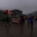
Canada Day Parade

Canada Day Parade

We had planed to stay in Dawson for two days, to visit all the sights, but Canada Day, which celebrates Canada’s achievement of Commonwealth status with England, is July 1st and we thought it would be fun to join in the festivities. Also, the weather was rainy with very low clouds and driving the Top Of The World Highway, which is a dirt road with hairpin turns and steep drop-offs, would not be all that much fun.

More Dawson City Photos


← older posts newer posts →