Ed McMullin


6/11

6/11   Tried my luck at fishing and hooked a good sized pickerel ( about 20″) worked it for a minute or so but then it threw the hook ( NWT requires that hooks be barbless, so I’ll blame the loss on that). Fished for another hr or so but no further action.

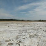
We drove to the Salt Plains, about 25 mi W of Fort Smith. Springs leach salt from subterranean salt deposits and percolate to the surface leaving vast salt sheets on the plain. Bear, wolf, buffalo and other wildlife tracks indicated that the salt is a large draw for animals, although none were visible this afternoon.

Salt Plains - from overlook

Salt Plains – from overlook


Salt Plains

Salt Plains


6/10

6/10  Leaving the campground, in the morning, we drove a short distance to the other twin falls, Alexandra Falls; again, no Niagra but worth the visit, and a bonus for Arlyne – no spiral stairway. Driving north along Hwy 1, the forests kept changing from mixed to stunted spruce and back again. Stopped for gas in Hay River and I asked the gas attendant what the winters were like.  He said that historically there was lots of snow in November into January and then it became too cold ( -40 to -50° C) for snow, but that recently the winters have been getting warmer. Last winter was unusually warm, only getting down to -20 or so, and even then only for short periods; then the temperature would rise to around +10°C, for a day or two – just enough to ruin things for snow mobiling.

Leaving Hay River we drove along Rt 5, about 50 mi of which was hard packed gravel in good condition but quite dusty.  Entered Wood Buffalo National Park, a UNESCO World Heritage Site which is larger than Switzerland. The Park protects the world’s largest (over 5000) free roaming herd of wood buffalo and is also the world’s only natural whooping crane nesting site. We didn’t see any buffalo or cranes – perhaps on the way out.

Camped at Queen Elizabeth Territorial Park, Fort Smith, NWT.
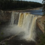
Alexandra Falls
Alexandra Falls


6/9

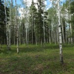
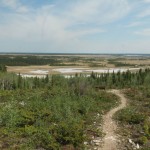
Typical NWT Forest

Typical NWT Forest

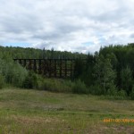
Wooden Railroad Trestle

Wooden Railroad Trestle

6/9   A gray drizzly start to the day, although the temperature wasn’t too bad – high 50s. Heading north along Rt 35 from High Level was pretty but fairly boring because the road was straight as an arrow and the forest, which was a colorful mix of spruce, birch and aspen trees, lined the road so you couldn’t see beyond; it was like driving through a tunnel of trees. We passed a wooden railroad trestle which was steaming in the sun after a passing shower but other than that nothing of note came into view.


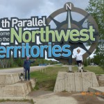
We Made It!

We Made It!

Wahoo! Finally reached the Northwest Territories. Had a most informative conversation with the park ranger at the Welcome Center; she told us about the prettiest places to go, where to get gas – there are probably not more than 10 gas stations in all of the NWT), the best places to camp and where to find food stores. She also explained a little of the history of the region.
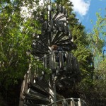
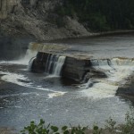
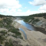
Camped at Louise Falls Campground, Twin Falls Gorge Territorial Park, Enterprise, NWT. Hiked down to Louise Falls, in the Hay River Gorge ; not Niagra but pretty enough and the sun broke thru so the hike was quite enjoyable, except for the spiral stairs which were not Arlyne’s cup of tea. The trail except for the stairs, of course, was that used by the Dene (the aboriginal people of the region) to portage their canoes around the Louise and Alexandra falls on their way to Great Slave Lake (Slave is the name for the Dene tribe who live in the area).

Not Arlyne's Favorite

Not Arlyne’s Favorite

Louise Falls

Louise Falls

Hays River Gorge

Hays River Gorge


6/8

6/8   An uneventful drive north. Stopped at Peace River to gas up and tried to find the statue of Twelve-foot Davis, a gold miner who struck it rich on a 12 foot slice of land, between two larger claims in the Cariboo gold fields. You wouldn’t think that a 12 foot statue would be hard to find but everyone we asked pointed us in different directions and The Visitor Center was closed so we struck out. Camped at Aspen Ridge Campground in High Level, AB.  For the next several weeks cell phone, an thus hotspot, reception will probably be very spotty so updates will be a problem.

Flat, flat, flat

Flat, flat, flat


6/7

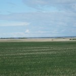
6/7   Northern Alberta is much like Saskatchewan except it is even flatter and has more oil wells and oil pumping stations. Camped at Sherk’s RV Park, Valleyview, AB.


6/6

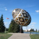
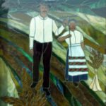
6/6    Another slow start, my wireless mouse died; found a Best Buy and bought a replacement. Left Saskatoon around 11:30 heading towards Edmonton. The prairie winds were fierce and dropped our gas mileage down to less than 10 mpg, our average had been 13 -14. The countryside is very dry, quite a change from Minnesota and North Dakota. Camped at the Elk’s campground in Vegreville, AB. The Vegreville area was settled by Ukrainian immigrants in the early 20th century and the Elk’s park displays plaques and artwork  including a large decorated Easter egg or pysanka which was constructed using more than 3000 aluminum panels.

Vegreville's-Pynsanka

Vegreville’s-Pynsanka

Tribute to Settlers

Tribute to Settlers


6/5

← older posts newer posts →


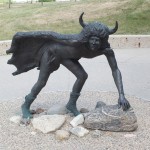
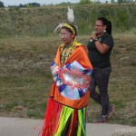
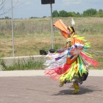
6/5    While we were waiting around to get our Rogers hotspot we decided to go to the Wanuskewin Heritage Park ( Wanushewin is Cree, meaning “being at peace with oneself”) . This park, in the Opimihaw Creek valley, was used by the First Nation people of the Northern Plains for more than 6000 yrs as a meeting place, a shelter from harsh winter winds ( the valley is perhaps 100′ deep and 600 – 1000′ wide which created an exceptionally good wind shelter and walking along it gave us a feeling of comfort and safety), and a buffalo killing ground (the buffalo were stampeded off cliffs and fell to the valley floor). The park has been the site of the longest Canadian archaeological dig, led by Dr Ernie Walker since 1984. We talked with Dr. Walker, while he was supervising a dig by his students; he allowed us to handle several artifacts found earlier in the day. One, a 4000 yr old spear point was incredible – it was so delicate in appearance and yet quite robust; it beautifully showcased the precision and skill of the ancient craftsman.

Wanuskewin First Nation Buffalo Hunter

Wanuskewin First Nation Buffalo Hunter

Cree Dancer

Cree Dancer

Cree Dancer in action

Cree Dancer in action


6/4

6/4   The Saskatchewan prairies are starkly beautiful, you see a rich euphony of cropland colors stretching out, in most directions, to the horizon – it’s pleasantly hypnotizing. Stopped into a Rogers store in Saskatoon and with the help of Chris who after innumerable failed attempts to sign us up called the corporate headquarters and waded through the supervisory structure until he found someone who knew exactly what to do. The upshot is that we should be able to get a Rogers hotspot tomorrow after a credit check is run, and thus have wifi throughout most of Canada; it turns out that we don’t even need a Canadian bank account. It just shows that unless you find someone like Chris, who is willing to go the extra mile, you simply get whatever quick and easy answer pops into their heads.

Camped at the Saskatoon 16 West RV Park. Nicely set up with spacious sites and a vast field to let the dogs run in. We’ll have to see about the showers.

newer posts →


6/3

6/3   Stopped into a Royal Canadian Bank, in Potage la Prairie, and Sherie said we could get an account so we signed up; now we’ll have to wait until Saskatoon, to find a Rogers store and hopefully get a Canadian hotspot.
Anyhow, This took all morning and we finally hit the road about 1 pm and headed towards Yorkton, Saskatchewan on the Yellowhead Hwy (Rt 16) [ the Yellowhead Hwy is named for the secret trail of its namesake, a blonde Iroquois Métis guide Pierre Bostonais who was know as “Téte Jaune” (translates as Yellow Head). The country along the way is basically flat, but picturesque, as it was in Manitoba and Minnesota, although it gets more like a billiard table as we go west and Saskatchewan makes Minnesota look like the Rocky mountains. Camped at the City of Yorkton Campground which has very nice secluded sites and beautifully landscaped, the only negative, the showers are the pits.


6/2

6/2 Rain on and off all day, sometimes just sprinkles other times deluges. At least The farmers are happy since the spring was too dry for seeds to sprout, now they are re-seeding and the land is turning green.

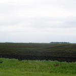
Minnesota Farm Field

Minnesota Farm Field

I had forgotten how rich the soil is throughout Minnesota, it looks as though anything would grow without much effort. Farming is difficult and backbreaking even with this soil but the region is a basket of plush farms; unfortunately, mostly corporate farms of many thousand acres. Not too many family farms left.

Finally entered Canada, just in time for another rain squall. Stayed at the Winnipeg KOA because there were no Provincial parks within a reasonable distance of our route. From here on travelog updates will be spotty since internet access will be catch as catch can. We have been using a Verizon hotspot in the States but roaming charges are outrageous in Canada so we’ll have to make do with wifi hotspots at libraries and other public places.


6/1

6/1   Spent most of the morning shopping, paying bills online, making photo copies of our living wills and health care proxies, going to the Post Office and similar menial but necessary tasks. Left Duluth around 1:00 and drove Rt 2 to Bemidji where we stayed at the KOA campground. Most of the time we avoid commercial campgrounds because we have found that State Parks, County Parks and National Forests offer nicer accommodations in generally prettier locations and are usually less expensive. However, every now and then laundry needs to be done and the facilities in commercial campgrounds are just more convenient.